How Sedgwick County redraws political districts could affect government for years to come
READ MORE
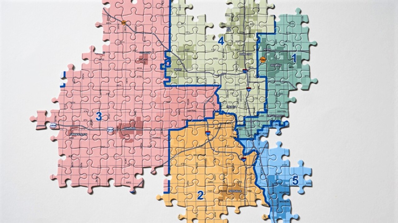
Changing Sedgwick County’s district boundaries
Sedgwick County is about to redraw the five commission districts in the county. So far, there are 10 proposed redistricting maps that the public can weigh in on Monday before the County Commission decides who will represent whom.
Expand All

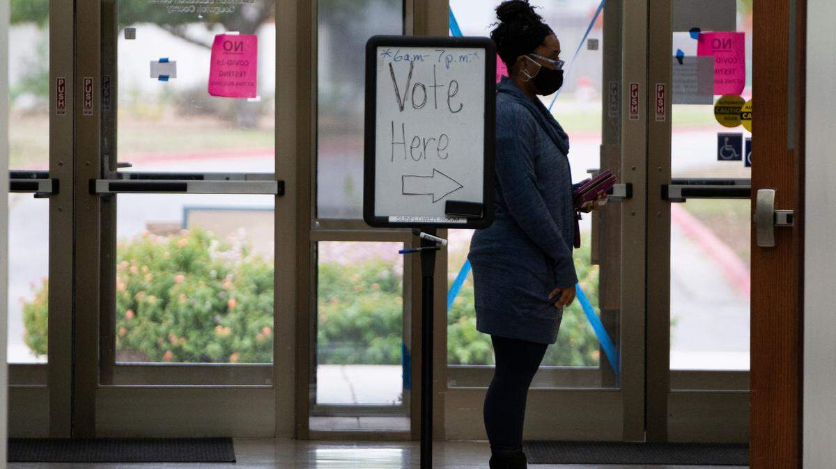
A foundational principle of American government is that the voters get to choose their politicians.
But once every 10 years, the politicians get to choose their voters.
This is that year.
Federal and state law requires that representative districts be redrawn after the U.S. Census completes its once-per-decade count of the population.
State and local governments are required to reset their political boundaries to account for 10 years of population shifts and create districts that are more or less equal in population size.
While that may sound like a simple mathematical exercise, the stakes in redistricting are high.
County commissioners are the primary local governing authority in unincorporated areas.
And even within cities, they control key levers of power, including health policy, disaster response, ambulance services and disability services.
Depending on how the county draws its boundary lines, you could:
▪ Get stuck with a county commissioner that you loathe and have never voted on.
▪ End up in a district dominated by one political party, where the election is essentially decided in a primary open only to that party’s voters.
▪ End up in a district with few voters who share your governmental interests and where your particular concerns are not on the radar.
Although all governments have to redraw their district lines, Sedgwick County is taking the lead in doing it.
So far, the county has issued 10 proposed redistricting maps that the public can weigh in on before the County Commission decides who will represent whom.
One of those, Plan 10, is an alternative from Commissioner Jim Howell.
His complaint with the current districts and the proposed ones is that little attention is given to balancing anything other than population.
As a result, he said, his district has several concentrated areas of urban poverty, crime, drug use, mental health issues, drainage problems and degraded streets that he can’t get addressed.
“It’s hard to move policy forward to address these issues, because every district doesn’t have the same problems to the same degree,” he said.
Howell hopes to re-balance the urban/suburban/rural balance of the districts so his colleagues will also have a stake in solving urban problems.
Commissioner Lacey Cruse, who has the most populous district and thus stands to lose some neighborhoods, also has proposed a map, designated Plan 9.
Cruse said she drafted the map to minimize the number of people having to move to a district that’s on a different election schedule.
Because commissioners’ four-year terms are staggered, voters who are moved out of districts that last elected a commissioner in 2018 could have to wait until 2024 for their next chance to vote.
Cruse’s proposed map was distributed to commissioners on Nov. 2 but was not added to the county’s public map dashboard website until Wednesday.
On Monday, the county will hold a town hall-style meeting to hear from the public about what they want to do going forward.
The Eagle has analyzed the proposed maps to determine how each proposal could shape the political and social balance of the county for the next decade.
Here are 11 things you need to know to be part of the process.
Why redistricting?
The basic logic behind redistricting is to balance populations among legislative districts so everyone has roughly equal representation.
It takes place every 10 years because, over time, populations shift. Some areas gain residents and some lose residents.
For example, let’s say that one County Commission district were allowed to have twice as many people as another district.
That would mean each individual’s vote in the larger district would be worth only about half as much as a vote in the smaller district when it comes to choosing a commissioner. That wouldn’t be fair.
How much do districts vary in size now?
The largest district by population is District 4, represented by Cruse, with 109,341 people.
The smallest-population district is District 2, represented by Commissioner Sarah Lopez. With 99,804 people, Lopez’s district is about 9% smaller than Cruse’s.
The goal is to have all districts within 1% of the others, so it’s clear Cruse’s district will have to shed voters and Lopez will have to pick up some.
The other three districts are all within 1% of the target number.
What’s the target number?
Ideally, each commission district should have 104,765 voters in it. That’s the target.
But perfection is practically impossible, because the commission districts are divided into voting precincts of varied population sizes. The goal is to get the districts as close as possible to 104,765 without splitting any precincts.
Who made these maps, anyway?
Eight of the maps were drawn by the Sedgwick County Department of Geographic Information Services, without input from the elected commissioners, according to county officials. They were then provided to the county counselor’s office for legal analysis. Howell and Cruse sought their own proposals.
The GIS maps are a starting point. They range from simple plans that move the fewest voters to complex redrawing of boundaries that would affect tens of thousands of people.
Why not just move voters from District 4 to District 2?
Only one of the proposed maps, called Plan 3, contemplates a direct swap of voters between Cruse’s District 4 and Lopez’s District 2 without altering other districts’ boundaries.
Another map, Plan 4, is similar, but it also moves a handful of voters from District 4 to District 3 to straighten the jagged boundary that now separates the two districts.
Either of those plans would work in terms of population, but there are political and social concerns that could cause issues for commissioners if they did that.
What are some of the other issues involved in redistricting?
The racial makeup of districts is an important consideration. The federal Voting Rights Act specifically forbids redistricting plans that discriminate against people of color or members of language minority groups.
In addition, governmental bodies generally shy away from dividing what are called “areas of interest.”
There is some justification for that because, for example, appending a more affluent neighborhood to a lower-income area usually generates complaints from the people who are moved that their concerns with government are different than the rest of the district’s and that they could get the short end of the stick when it comes to representation. The converse is also true when a small number of low-income residents get attached to a richer district.
There are also political considerations. Moving a large number of Democratic or Republican voters to another district can alter the balance of power, which has rested in Republican hands for more than 20 years.
The last time Democrats held the majority was 1998. Republicans have held either a 5-0 or 4-1 supermajority for 15 of the 23 years since.
What are some of the political implications?
Moving district lines changes the balance between Republican and Democratic voters.
For example, Plan 3, the one with the fewest changes, would move voters in the Democratic-leaning Riverside neighborhood from north Wichita-based District 4 to south Wichita-based District 2.
In the 2018 election, Cruse, a Democrat, beat incumbent Republican Richard Ranzau by 3,534 votes overall.
Nearly a third of her margin of victory (1,121 votes) came from three precincts in Riverside and Indian Hills that would move from her district to Lopez’s under Plan 3.
In 2020, Lopez eked out a 264-vote victory over scandal-plagued incumbent Michael O’Donnell, who had agreed to resign if re-elected but continued to campaign so that if he won, the Republican Party could choose his replacement.
Shifting Riverside to Lopez’s district would increase her chance of re-election, while reducing Cruse’s.
Howell’s Plan 10 adds five Republican-dominated precincts to District 2, which might doom any chance Lopez has of being re-elected.
Cruse’s map, Plan 9, would boost her re-election hopes. Although she would lose some Democratic voters to District 2, she would shift hundreds more Republicans to neighboring District 1, a Republican stronghold represented by Republican Commissioner Pete Meitzner.
Who decides who goes where?
That decision will be made by the five members of the County Commission. Commissioners have the option of accepting one of the maps, proposing a map of their own that meets the legal guidelines for redistricting, or asking GIS to draw up more scenarios.
The official vote has not been scheduled but is expected by the end of the year.
What if I like (or dislike) my commissioner? Can I affect which district I wind up in?
The public will get the opportunity to weigh in on redistricting at a town hall meeting scheduled for 6:30 p.m. Monday. The meeting will be held in the lecture hall at the National Center for Aviation Training at 4004 N. Webb Road, adjacent to Col. James Jabara Airport.
The meeting will begin with a presentation on the proposed maps and conclude with a period for questions and comments.
Does public input really influence redistricting?
At the local level, it has been known to.
The most prominent local example came in 1998, when public outcry from residents of the upscale Willowbend and Teal Cove neighborhoods prompted the Wichita City Council to dump a plan to shift those residents from the affluent and mostly white northeast-side District 2 to neighboring District 1.
District 1 is a more low-income urban area with a large minority population. It has been represented by an African-American council member since the city established election by districts in the 1980s.
While district boundaries are usually redrawn only every 10 years, the council redistricted between censuses in 1998, after the city attorney advised that the existing districts were so unbalanced in population that they were in violation of the Constitution.
The council members tweaked the map again in 2002 based on numbers from the 2000 Census.
When will the city and state do their redistricting?
Not for a while. The city of Wichita doesn’t plan to begin its redistricting until after the state sets new boundaries for congressional and state House and Senate districts, said Wichita Mayor Brandon Whipple.
The legislative session starts in January, but state redistricting isn’t expected to be completed before late next spring at the earliest.
Last time around, conservative and moderate Republican factions fractured and were unable to complete the redistricting process. A panel of federal judges had to redraw the districts in time for the 2012 election, and the city didn’t do its redistricting until July of that year.
How to learn more, comment
What: Town hall on redistricting proposals
When: 6:30 p.m. Monday
Where: Lecture hall at the National Center for Aviation Training, 4004 N. Webb Road
This story was originally published November 14, 2021 at 5:05 AM.