Weather Service assessing storm damage, intensity of Andover tornado
READ MORE
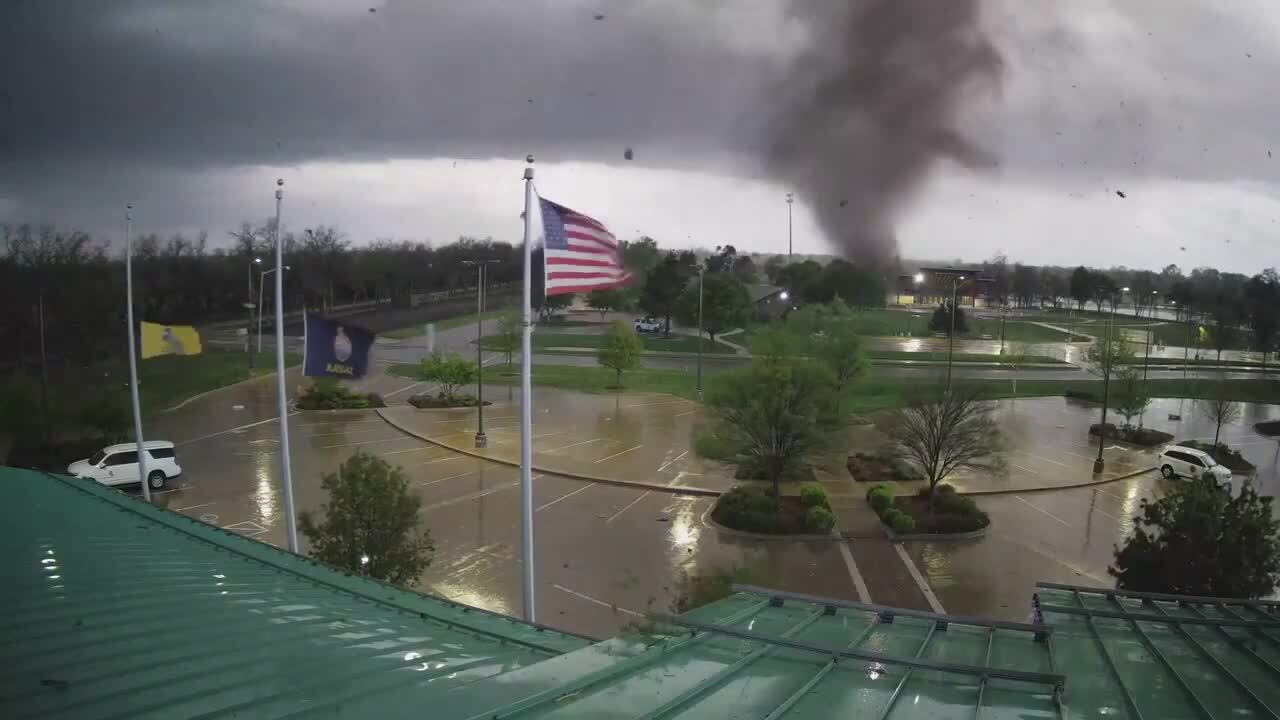
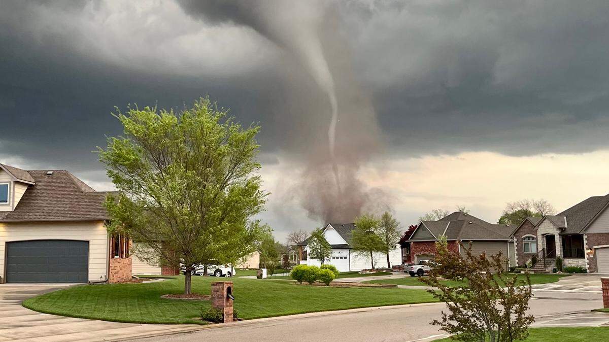
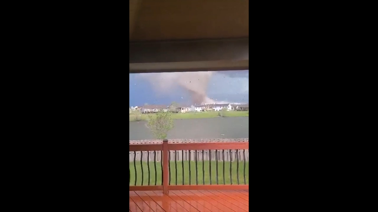
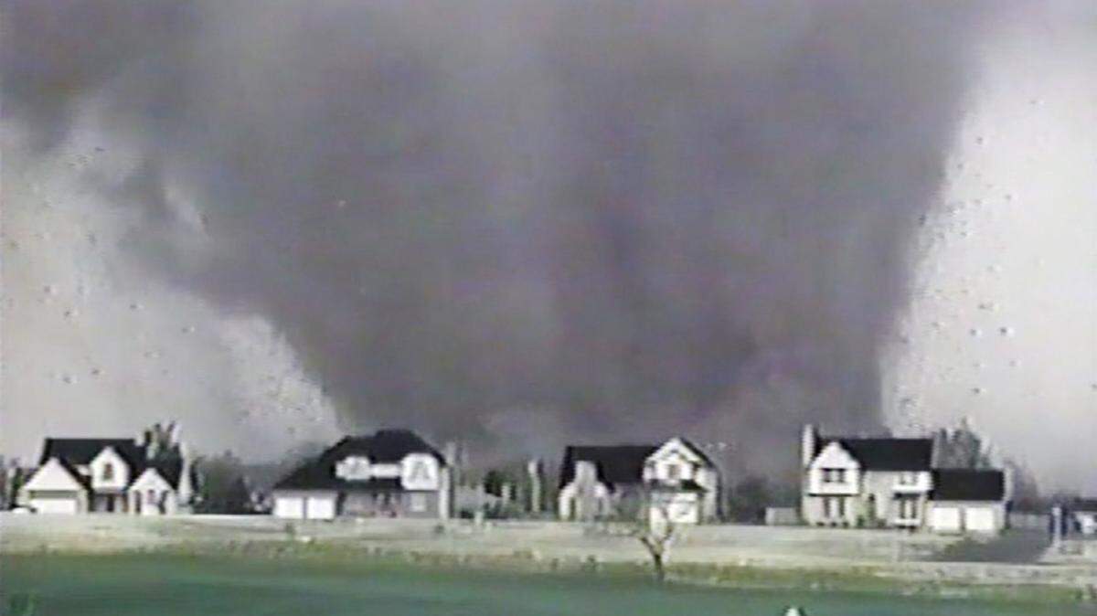
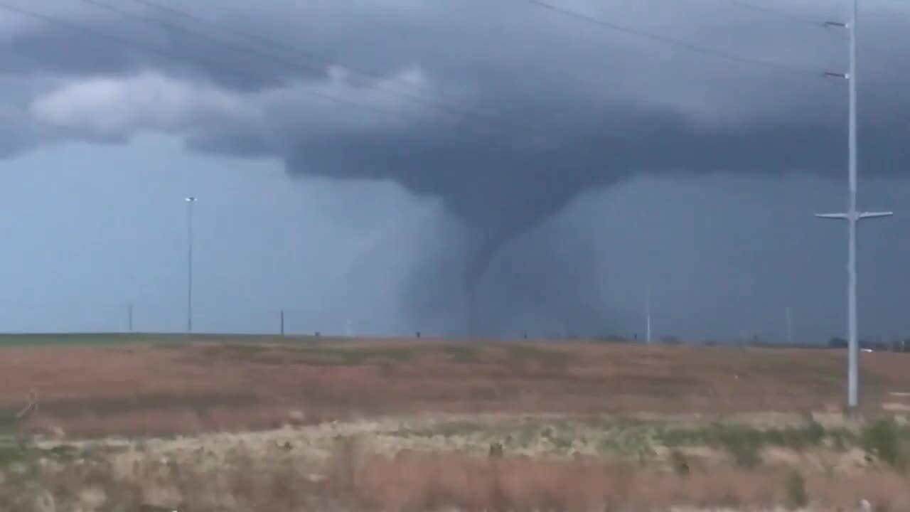
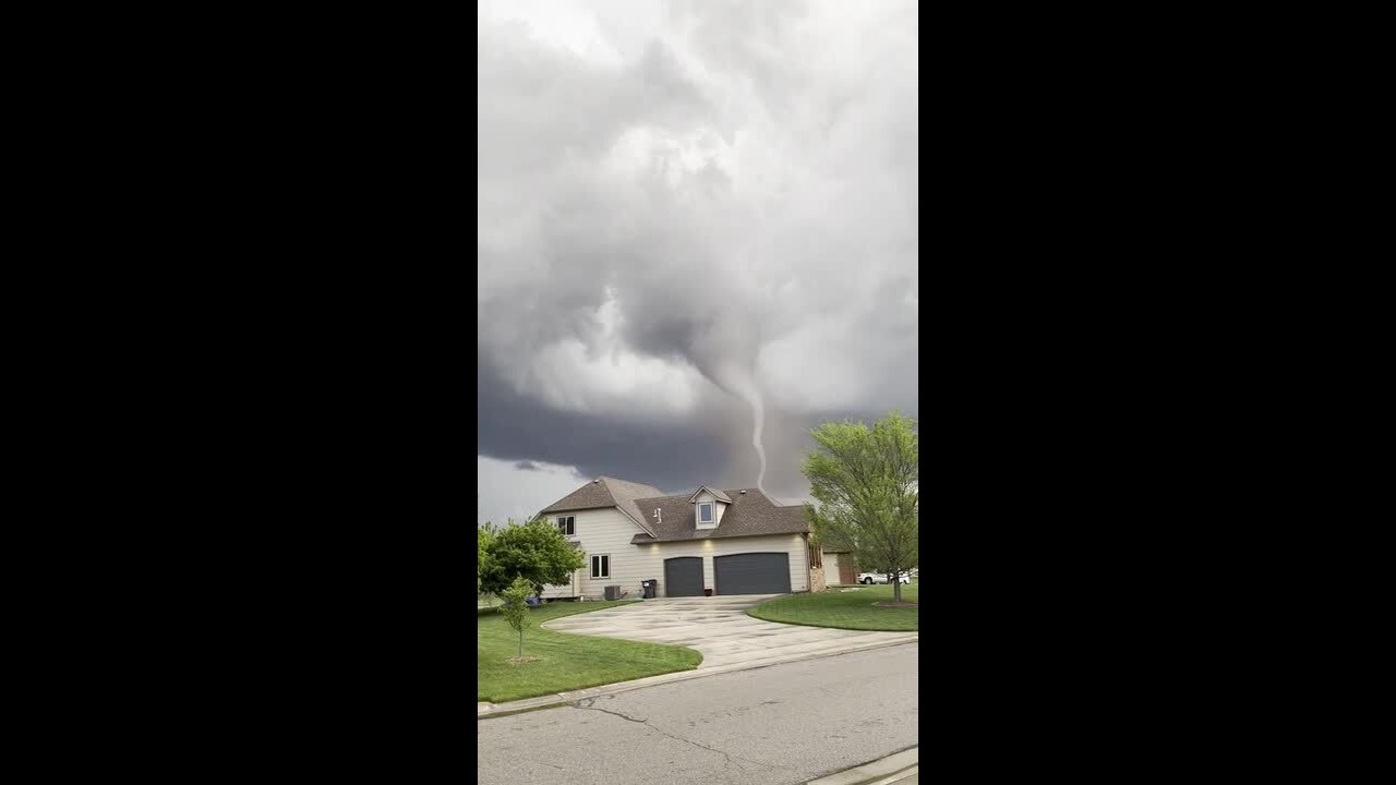
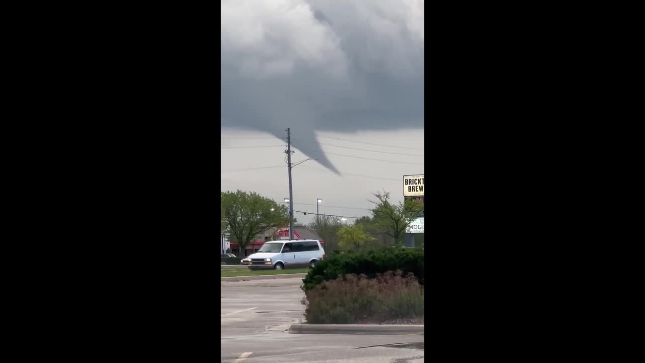
Tornado cuts through Sedgwick County and Andover, Kansas
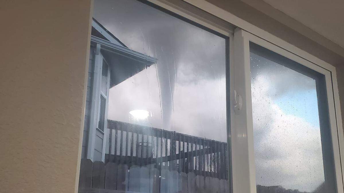
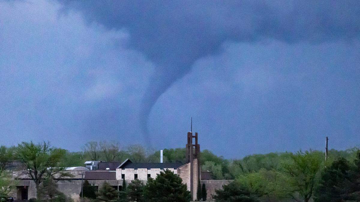
An EF-3 tornado touched down in south-central Kansas on April 29, 2022, leaving damage in its wake, but few injuries. Residents in the Wichita area, Andover and Sedgwick and Butler counties are picking up the pieces.
Expand All
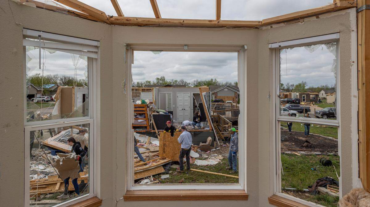
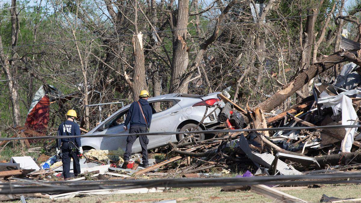
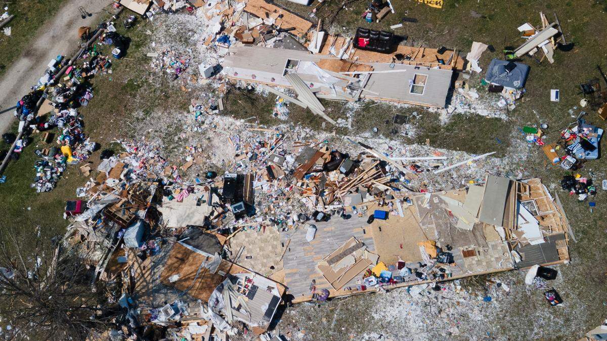
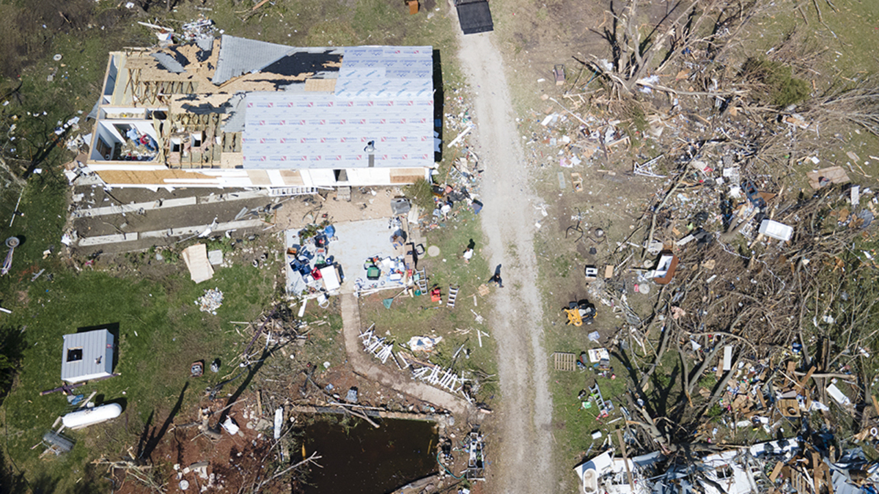
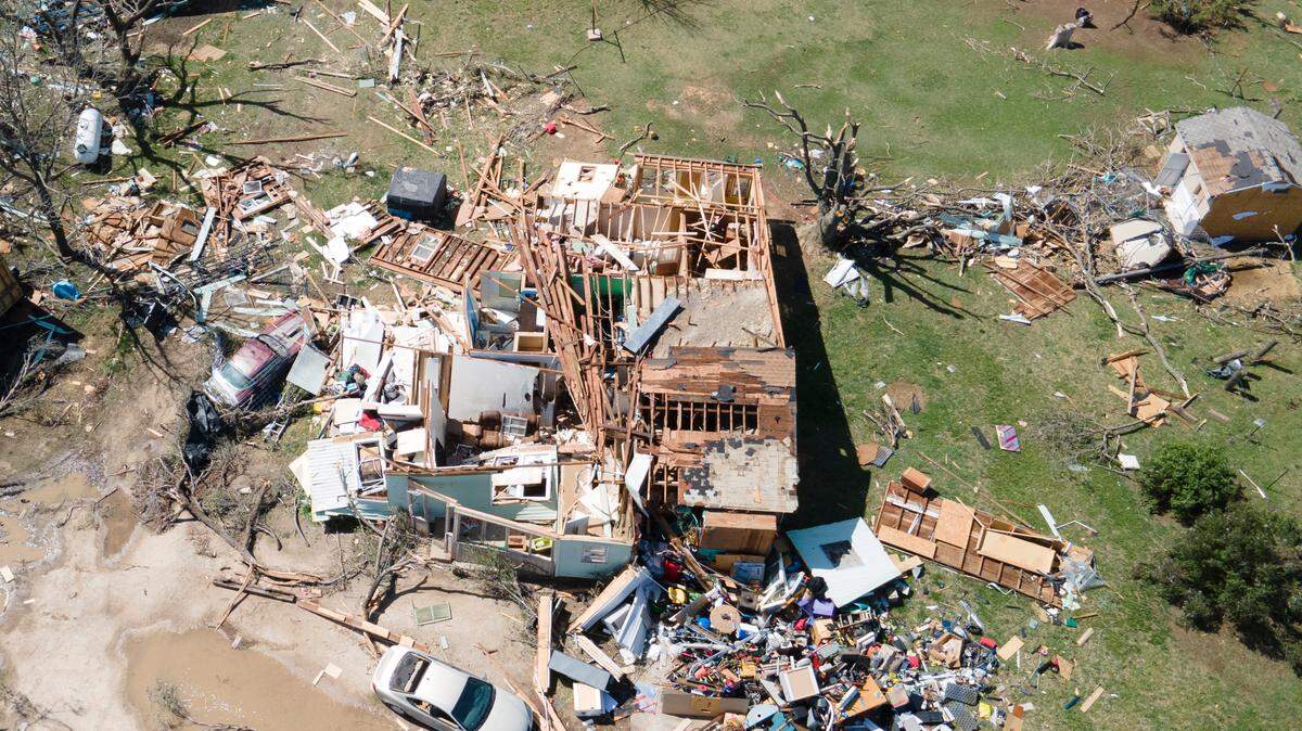
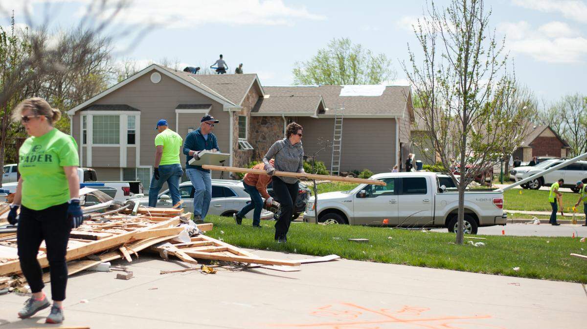
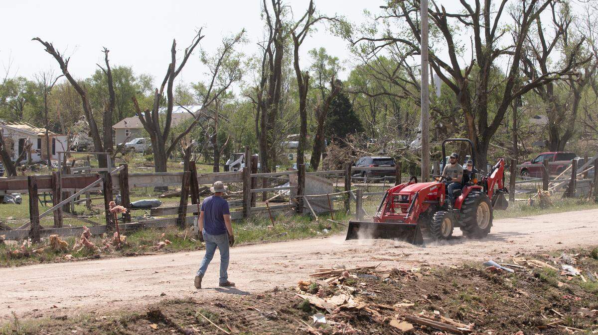
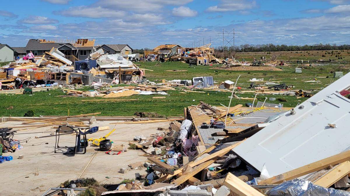
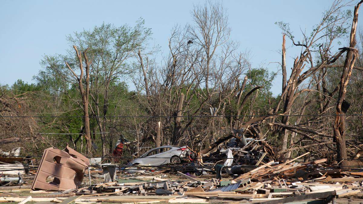
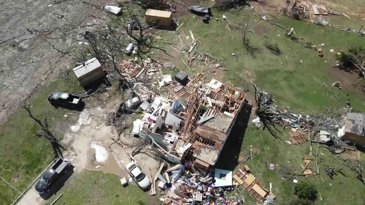
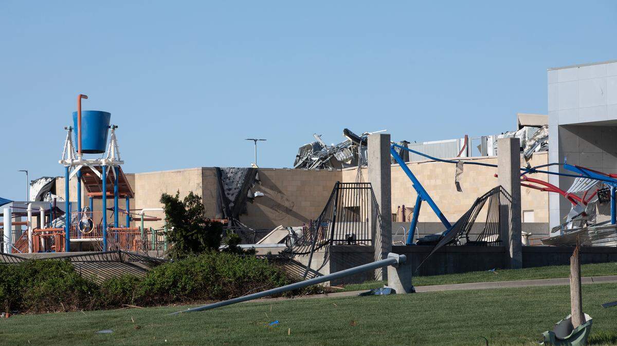
A tornado that tore through parts of Sedgwick and Butler counties on Friday evening caused extensive damage to buildings, uprooted trees and downed power lines. But on Saturday morning, as the rising sun revealed more of the destruction, it was still too early to know exactly how strong the storm was.
The National Weather Service in Wichita said Saturday morning that assessment teams would spend “most of the day” determining the extent of the damage so it can rate the tornado’s intensity and figure out its general path.
“We have damage assessment teams that are out right now, looking at where the damage is and the degree,” NWS meteorologist Vanessa Pearce said.
“But it’s going to take us time to go through.”
The weather service could release an intensity rating for the tornado, which Pearce said is based off of the degree of damage, and its path, as early as Saturday. But it could take longer, depending on the damage, she said.
Tornadoes are rated using the Enhanced Fujita (EF) Scale, which is based on estimated wind speeds and related damage. Ratings range from an EF0 to an EF5.
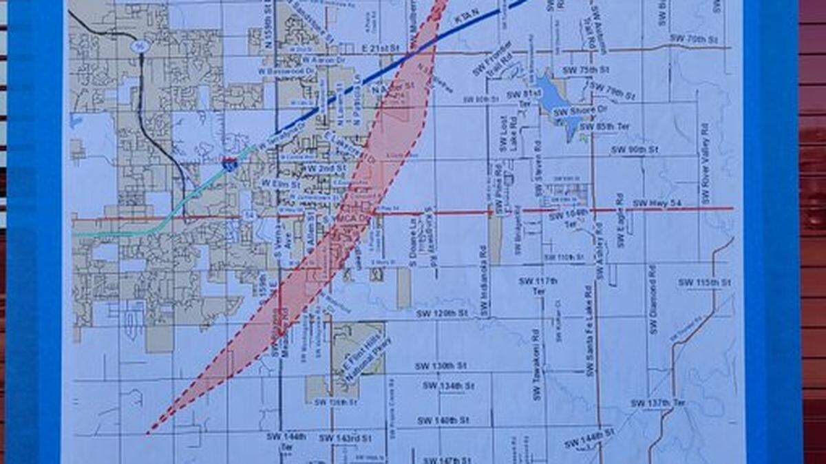
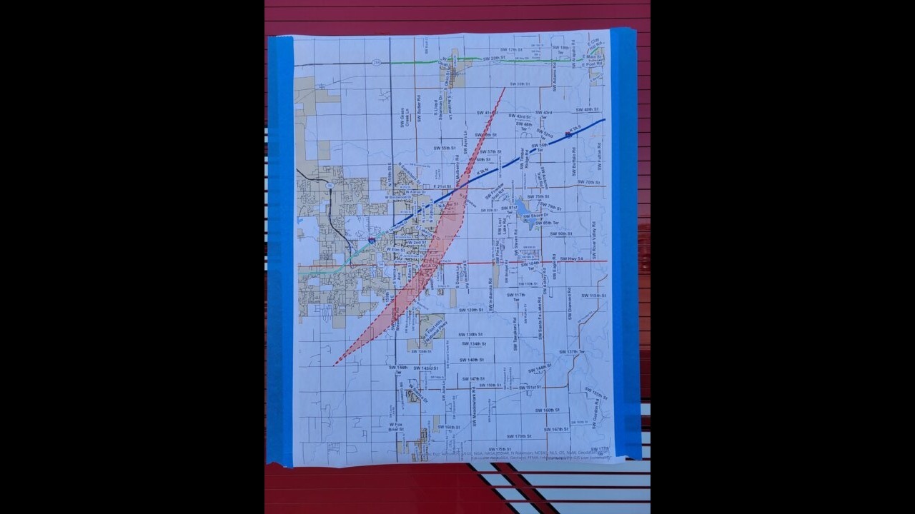
Although the exact path of the tornado was being determined Saturday, officials overnight listed some of the areas in the trajectory: the neighborhood at the northeast corner of Harry and Andover Road, the southwest corner of that intersection, the Reflection Lake neighborhood and Central Park east of Crescent Lakes.
Pearce said the first preliminary report of the tornado came in around 8:10 p.m. in the area of South 127th Street and East 39th Street. It traveled several miles, up to at least 60th or 70th Streets, apparently strengthening as it headed north, officials have said.
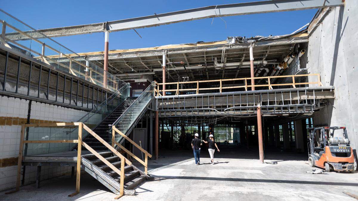
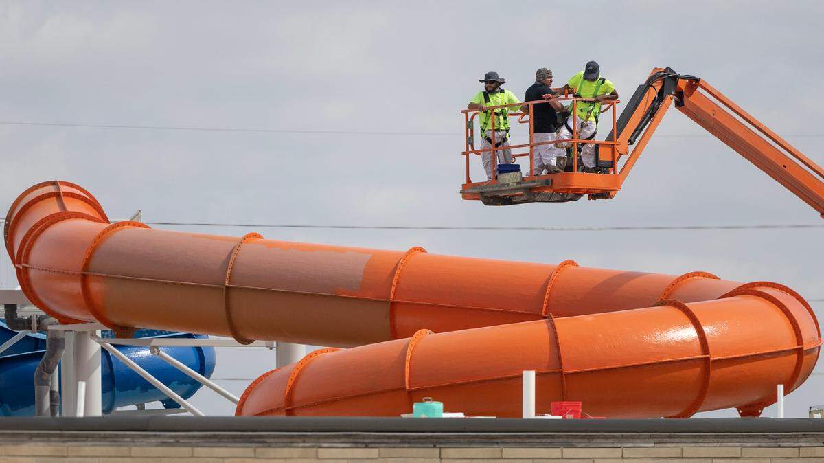
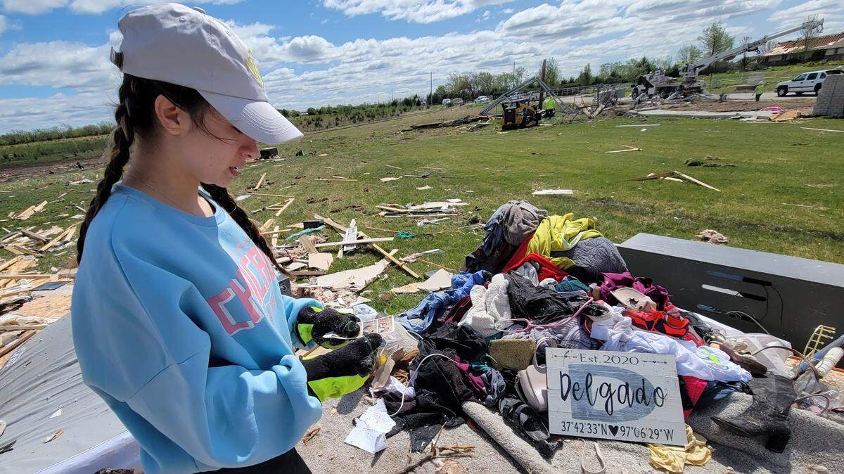
Officials said Saturday that the damage path is 3 1/2 or 4 miles longer than originally thought. Daylight revealed the additional destruction. One who spoke at a noontime news conference in Andover said an estimated 1,000 structures were affected in some way by the storm.
But the count will likely rise as assessments continue.
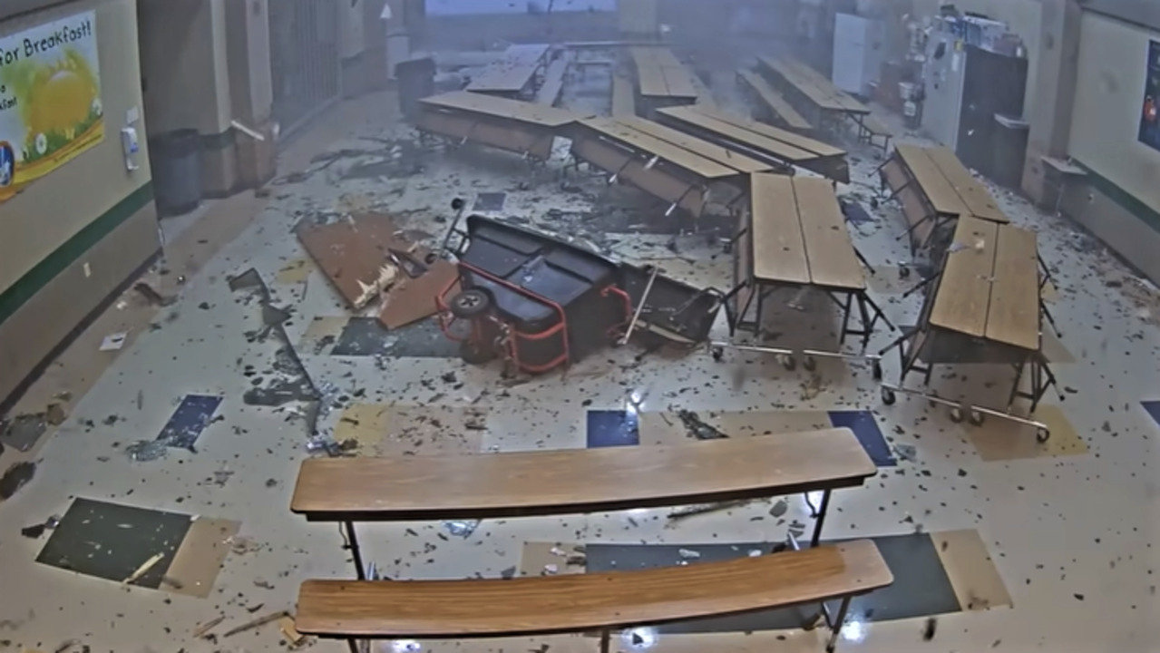
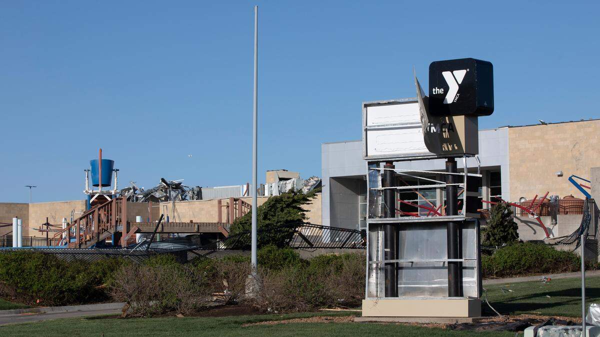
It wasn’t immediately clear Saturday morning exactly how many buildings sustained damage. Several homes, Prairie Creek Elementary School and the Dr. Jim Farha Andover YMCA were among the worst hit.
Wichita Mayor Brandon Whipple said Saturday by phone that the fire department is estimating 20 to 25 structures inside Wichita city limits were impacted by Friday’s storm.
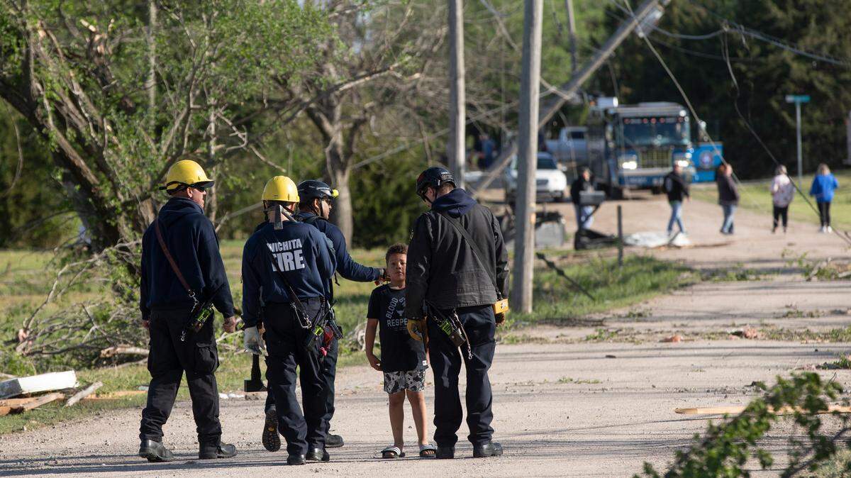
So far, there have been no fatalities and only four injuries. Search and rescue teams continued Saturday to comb through areas effected by the storm; an Andover official at noon said about 70% of the area had been searched twice.
Sedgwick County Commissioner Pete Meitzner told The Eagle in a phone interview Saturday that no one was missing and everyone in the area had been accounted for.
The National Weather Service on Saturday morning was also still assessing how long the tornado spent on the ground, its width and how many miles it traveled, Pearce said.
Sedgwick and Butler counties weren’t the only areas in the region that tornadoes tore through Friday night. The National Weather Service damage assessment teams also spent Saturday surveying tornado destruction in across Marion County, where there were four confirmed tornadoes including two with an EF-1 rating, according to the agency’s preliminary damage survey results.
One of the EF-1 tornadoes, reported at 7:57 p.m. four miles north of Tampa, had estimated peak wind speeds of 96 mph. It had a .9-mile path and measured 30 yards wide, according to a National Weather Service tweet. The other, reported at 8:03 p.m. three miles southeast of Durham, had a .9-mile path and estimated peak wind speeds of 95 mph. It was 50 yards wide.
There were no injuries or deaths associated with either, the NWS said.
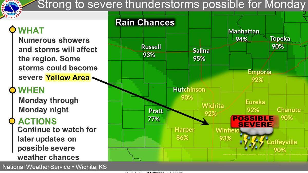
Pearce said the weather will be warm and sunny Saturday into Sunday as clean-up and assessment efforts continue in the area.
But there is a chance of showers and thunderstorms Sunday night into Monday that could turn severe Monday evening.
This story was originally published April 30, 2022 at 1:00 PM.