How much snow will Wichita, Kansas get this time & will roads be slick? Forecast details
Snow starting Thursday afternoon in Wichita and southern Kansas could make the evening drive home a slippery one.
The National Weather Service Office in Wichita issued a Winter Weather Advisory until 6 a.m. Friday for central, south-central and southeast Kansas.
A detailed forecast for Thursday in Wichita shows a 70% chance of snow, increasing to 90% at night. The high for the day is expected to be 33 degrees, dropping to 23.
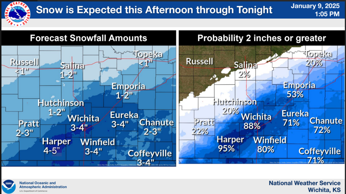
The snow is expected to start falling between 2 to 4 p.m. in Wichita and stop at 3 a.m. on Friday. Wichita is forecast to see 3 to 4 inches of snow. The probability of Wichita getting 2 inches or more of snow sits at 88%, the NWS said Thursday.


The snow could affect the evening drive home, with the highest intensity expected from 6 p.m. to midnight in southern Kansas. Drivers should plan on slippery road conditions, the NWS said.
“Slow down and use caution while traveling,” the NWS advisory said. “The latest road conditions for the state you are calling from can be obtained by calling 511.”
Friday is forecast at a partly sunny high of 30, with a low of 15. Saturday and Sunday will see highs of 34, and lows of 24 and 16, respectively.
This story was originally published January 8, 2025 at 2:04 PM.