
Report shows injuries, damage and details about eight Chase County, Kansas, tornadoes
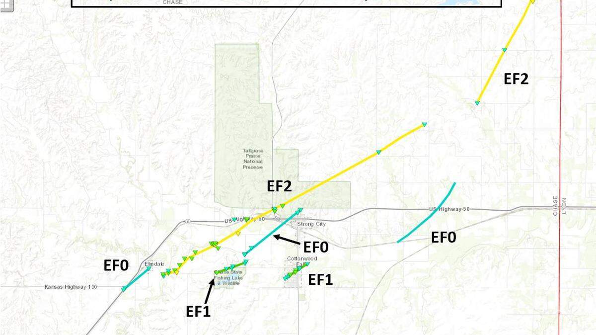
More details about the eight tornadoes that happened Wednesday in Chase County, including injuries and damages, were released in a report the National Weather Service in Wichita tweeted out Saturday.
Two people suffered minor injuries as a result of the tornadoes, National Weather Service meteorologist Robb Lawson said. One happened when a semi rolled near the intersection of Highway 50 and Highway 150. The other happened northeast of Cottonwood Falls, when a car was picked up and dropped. The person was injured by glass breaking.
Damages and destruction were recorded on outbuildings, agriculture buildings and a “transmission power structure,” the report says.
The tornadoes all started and ended between 8:13 p.m. and 9:07 p.m. and had estimated peak winds between 74-125 mph, putting the tornadoes between an EF-0 to an EF-2.
“As the storms progressed east they quickly intensified as they encountered better moisture,” the NWS said. “One storm in particular became the dominant storm that tracked across southern Marion and much of Chase county. This powerful supercell thunderstorm produced numerous tornadoes along with extremely large hail.”
The NWS report, which includes photos of the damage, can be found online here.