
Wichita area could see snow, rain, hail, chance of tornado, says weather service
The Wichita area could be in for a mix of weather conditions Wednesday evening and overnight: rain, thunderstorms, hail, strong winds and possibly a tornado, the National Weather Service said.
The weather service issued a wind advisory on Wednesday, predicting gusts of up to 45 mph across central and south-central Kansas. Gusty winds could send unsecured objects flying and blow down tree limbs. The wind advisory runs through 8 p.m. Wednesday.
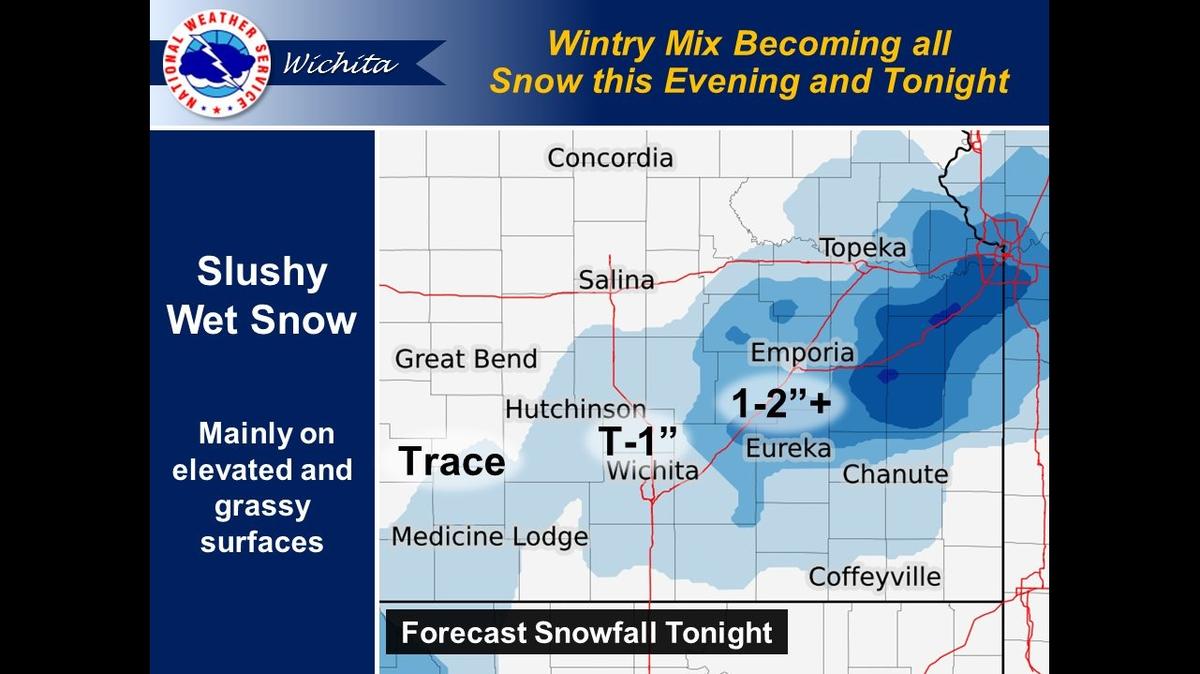
A winter weather advisory is in effect from 9 p.m. Wednesday to 7 a.m. Thursday. Mixed precipitation is expected to include total snowfall accumulation of 1-2 inches in some areas, with potentially more snow along and east of the Kansas Turnpike.
Strong winds may create blowing snow, reducing visibility. Slippery roads from the wet, slushy snow may affect the morning commute.
The NWS Wichita hazardous weather outlook, as of Wednesday morning, called for rain and thunderstorms during the afternoon and evening. Severe storms are possible, especially in southeast Kansas. Hail is expected to be between nickel-sized and quarter-sized, while a brief tornado could touch down in far southeast Kansas.
In the city of Wichita, the weather service forecast calls for a 100% chance of precipitation overnight. The best chance for snow will be between 1 a.m. and 2 a.m., though accumulation is not expected to be more than half an inch. The low temperature will be around 33 degrees, with wind gusts as high as 39 mph.
This story was originally published March 17, 2021 at 4:20 PM.